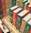
In Maphead: Charting the Wide, Weird World of Geography Wonks, Jeopardy! champ Ken Jennings surveys the world of the geography obsessed.
I confess I'm a closet maphead: I like road atlases, battlefield maps, Tolkien maps, everything. What makes maps so fascinating?
There is a prominent geek factor. Fantasy fans love their maps, and there are D.C. Comics atlases, Gotham City atlases, atlases of the Starship Enterprise. A friend hid her face in her hands when she told me she used to ask her parents for the Thomas Guide every Christmas. Part of the appeal of maps may be insecurity—wanting to understand what's around us in a big, scary world. And some people's brains just work better spatially. But it's also something poetic—an urge to explore.
What was the oddest geography subculture you encountered?
The geo-cachers. The simplicity of geo-caching is beautiful: somebody hides something and posts the latitude and longitude on the Web, and people look for it with GPS devices. They're essentially using multibillion-dollar military satellites to find Tupperware hidden in the woods. I met people who had found thousands of geo-caches; one guy hacked into the Mexican jungle to get one. I myself turned into a geo-caching junkie—"Gotta get one more!" I'd drag my eight-year-old along as a beard, and he'd be like, "No, Dad, not more geo-caching!"
You squared off against National Geography Bee contestants in a geography quiz. Who was tougher, the grade-schoolers or Watson [the IBM computer you challenged on Jeopardy!)?
I was in the game against Watson in a way that I never was against these geography kids. One girl slaughtered me 19 to 11—it was not even close. Watson would occasionally make a silly mistake, but these kids have no holes in their knowledge: the earth is a finite size, and they have it covered. They would tell me about going over flash cards for hours until family members told them to go away, reading reference books in the car, going to their brothers' Little League games and never lifting their heads from the atlas. The future is in good hands.
Are maps doomed now that we have GPS systems?
If we just let the GPS tell us where to turn instead of thinking, "What's the right direction?" we could make that part of our brains obsolete. But I see hope, because new technologies are making maps so cool. Maps didn't change for 500 years: a map from 1980 looked like a map from 1580. Nowadays, you can pull out your phone and see your friends advancing across a map to meet you; you can turn on Google Earth and dive through canyons. I hope this digital map revolution makes up for how we're stunting our geographic growth.


 Volume 258
Issue 19
05/09/2011


